Today we drove about 60 miles east to Hat Point overlook on Hells Canyon of the Snake River.

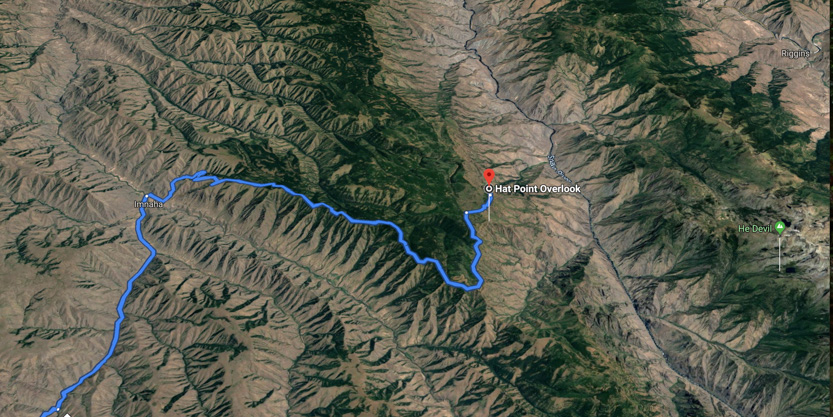
Because my Garmin GPS didn’t know about the overlook I was following Google maps from my phone. I had programmed the Garmin to at least get me to the end of the pavement at Imnaha. Google maps wanted to take the grey route because it was shorter. The Garmin wanted the blue route. Unfortunately I listened to Google. About 15 miles down the grey route, at the sharp turn south, it wanted me to turn into a rutted dirt road through a farmers field. We had to backtrack a long way until we found a road south to take us to the correct route.
We drove a through this grassy plain for nothing.

Hat Point is the highest point on the Oregon side of the canyon at almost 7000 feet in elevation. The river is 5600 feet below you.
Enterprise is at about 4000 feet in elevation. The road is paved to the very small community of Imnaha and drops down to 2000 feet. To get there you you drive through a very narrow canyon with very high volcanic walls.

I never got a good picture of the narrowest section but the drive to Imnaha was very beautiful. We should have stopped more and taken proper pictures.
At Imnaha the road turns to gravel and you start climbing. The first seven miles you climb from 2000 to about 4500 via a 16% grade cut into the side of a volcanic ridge.
On the Google Earth image you can see that we follow the top of a long ridge, with the steep switchbacks at the beginning.


The photosphere.
This was the only section of the road that had me worried. It was not the steepness but the rather sharp looking volcanic rock on the road. I am always worried about our non off road tires but we just went very slowly and had no problems.
Once we reached the ridge line there was a pullout for a viewpoint.

Looking south down the valley to the west of the ridge.

Looking back north, the way we came.

The photosphere.
From here on the road was very smooth, with only a few places with potholes. The climbing rate was steady but also much gentler for the rest of the 16 miles to Hat Point.

The road was mostly single lane as well, with a fair number of blind corners. Going in we only saw two trucks coming towards us, one when we were stopped. On the way out we saw 4 cars, all in spots where we could see them a long way off. The road was also very dusty so I am glad we never had to follow anyone.
Every once in a while there were pullouts or short side road to viewpoints looking west.
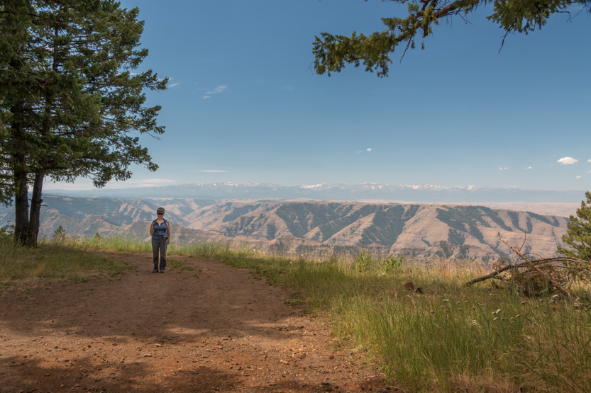
One with a short walk. You can just barely see the mountains behind Wallowa Lake in the background.


The photosphere.
Another across a small meadow.


The photosphere.


A roadside stop.

The photosphere.
The next stop. I know these are getting redundant but, once again, this is a record of what we did so I will include at least a few shots from every stop.


Me, doing my contortions to get all the shots for a photosphere.

The photosphere.

The lookout just before the turn east was called Granny View, I guess because it had a nice paved 1/2 mile looping path out to a viewpoint.
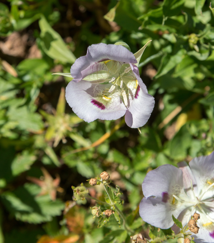
Lots of flowers here.


Looking north.

The photosphere.


Just about now our weather luck ran out. The forecast for today had been for clear sunny skies. You can see in some of the previous pictures that there is a layer of high cloud off to the south. The line between clear and cloudy skies was actually overhead and as we turned the corner east towards Hells Canyon, we were now under the clouds. Sun on Hells Canyon would have been so much nicer but you take what you get.
Our first roadside view down into the canyon, looking west. You can see some of the peaks of the Seven Devils Mountains on the far side of the canyon.


The photosphere.
I realize now that I forgot to take a picture of Hat Point as we were driving up to it. It is quite a developed area. There is a washroom, many picnic table, some covered, with fire pits.
Time for lunch.


We could finally see the Snake River almost 6000 feet below us.


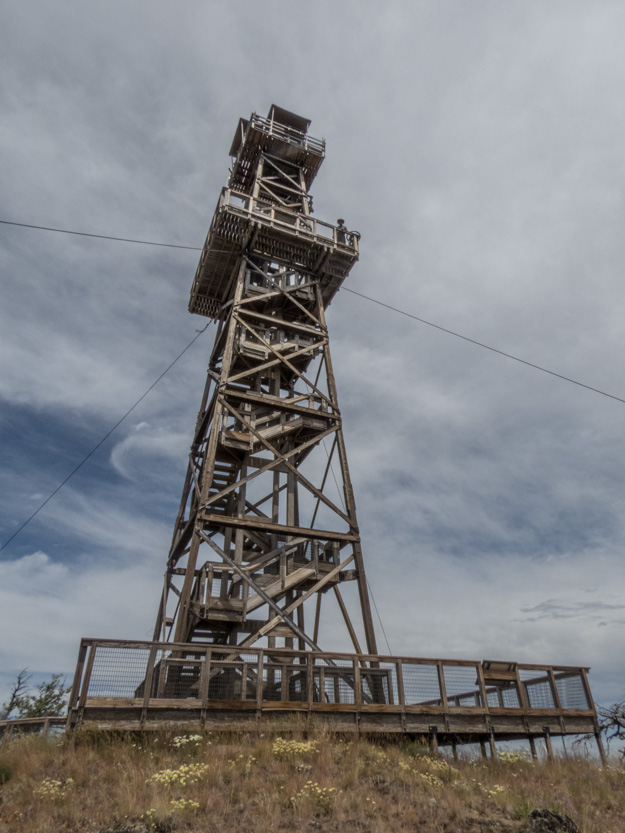
There is also a manned fire tower here. There is a small cabin near the parking lot where the person staffing the tower stays.

It is Oregon’s tallest fire tower at 82 feet.

You are allowed to climb it. It is 90 steps up to the first platform. I was a bit worried because it was really windy today but the tower didn’t shake at all.
Looking up the middle.

I went up to the first deck.

Then I heard someone talking to Jennie. I finally realized that it was the lookout person up at the top.

Normally I think you are allowed to go all the way up but he said that with the winds gutsing to over 40 mph it was not safe. I was being blown around a lot where I was.
Looking southeast to our picnic spot and the Seven Devils.


Looking southwest to the road. We did get a few sunnier periods.

Including Jennie below.

Not much to the northwest, again with Jennie below.

And the best view to the northeast.


The wide view to the east.

A photosphere including the tower and a photosphere where I walked around the edge to remove it.
Then the 1 1/2 hour drive back home.
Down to Imnaha.

Back up through the narrow canyon.

And across “the right way” towards Joseph.

As you can see the Wallowa Lake area did actually get a sunny day.
Heading through Enterprise we finally remembered to get a picture of this great treehouse.

Around dinner time tonight there were some dark, threatening clouds off to the west. I though we might get rained on but they passed us by to the north and we were soon back in the sun.

No comments:
Post a Comment